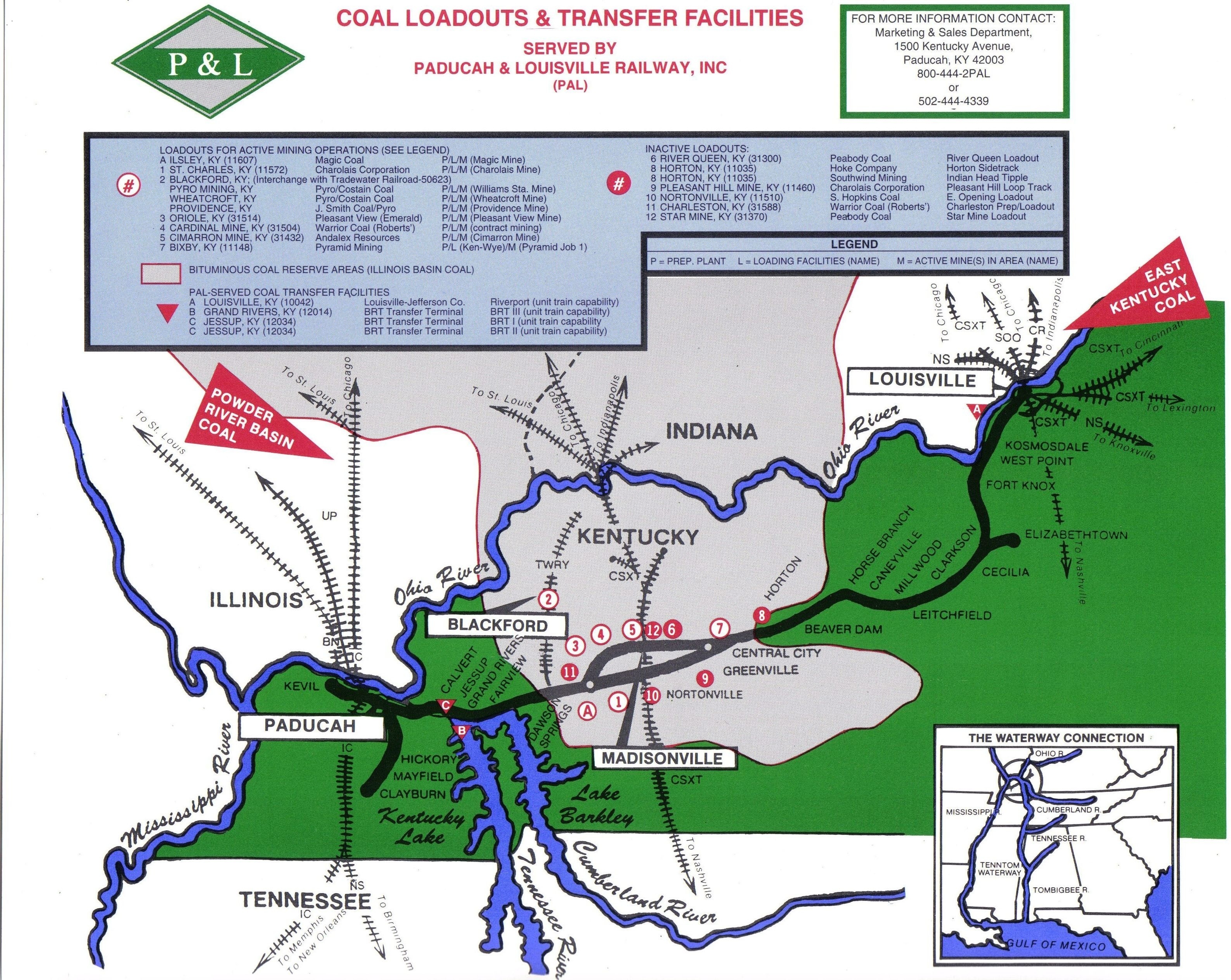
I don’t know the date of this map but it should date from the late80’s to early 90’s . If someone knows for sure I’ll update the information. Note the old main is shown and compare the route to the current 2008 map in particular how the connections have changed also most of the mines are not in operation prior to 2008.
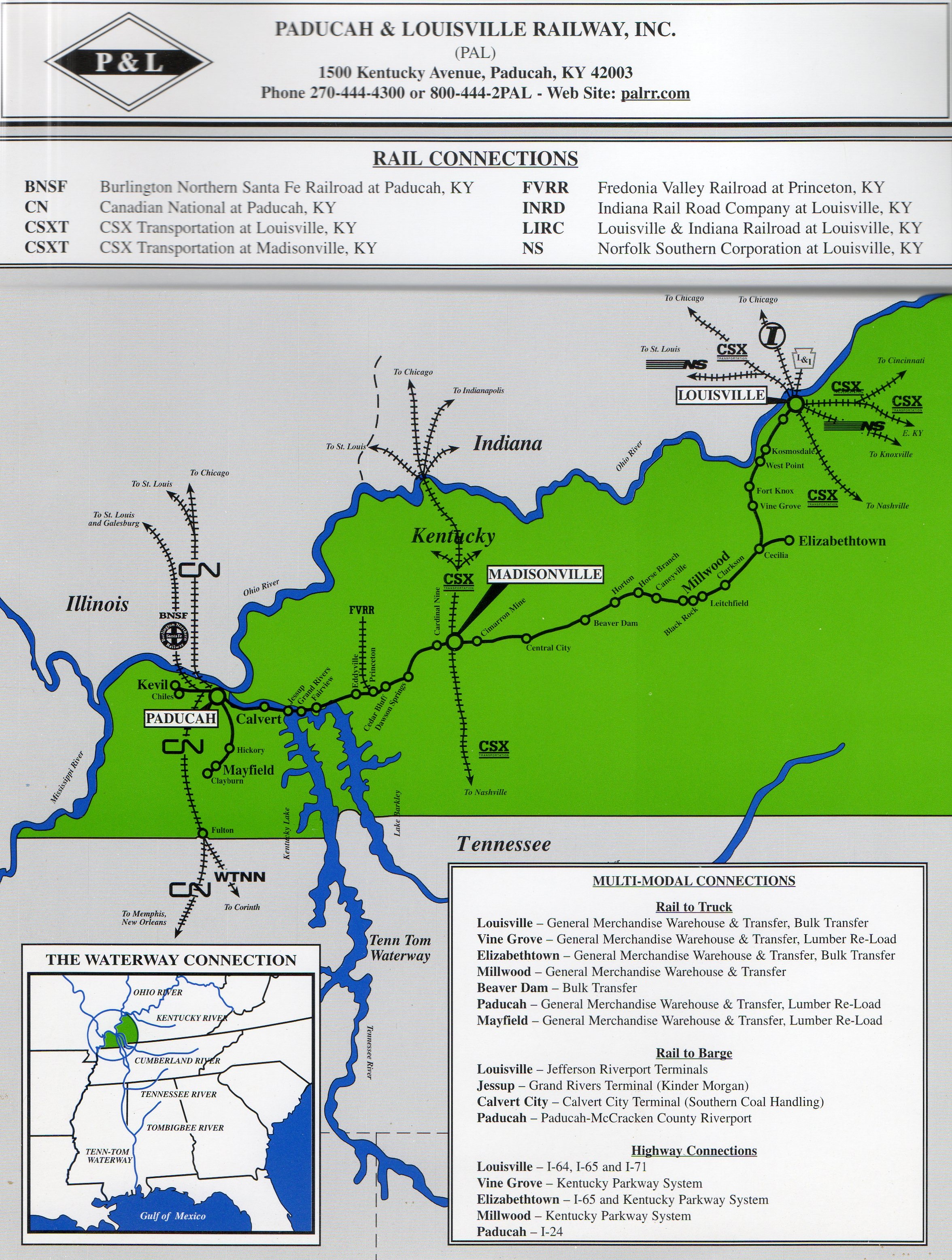
The 2008 map was in distribution at that time by the railroad and reflects the most current connections.